Assigning Service Latitude/Longitude by Viewing Loads on a Map
The goal is to collect a load at each Service such that the latitude /
longitude is sent to the Loadman Fleet Manager. Then the loads are viewed
on a map to determine which Service they are and then the latitude /
longitude of the load is assigned to the Service.
The detailed step to be followed are...
-
Have the Driver run collect from the Services for which to desire to get
the latitude / longitude.
-
For each load, select it from the LoadData view and then select edit
from the toolbar.
-
From the LoadData edit dialog, select Map Address. You will then see
a map that shows the location of the load with a gun site as seen
in the map below.
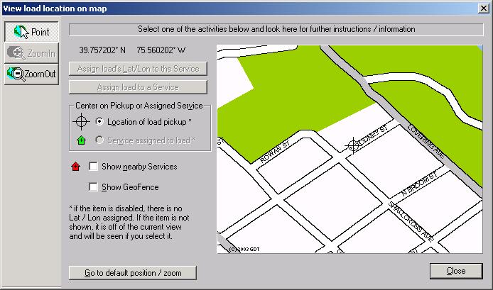
- From the map, determine the name of the Service.
-
Close the map and from the LoadData edit dialog, select the Service and then
click OK.
-
From the LoadData view open the context menu
and select Set Service Lat/Lon from LoadData.